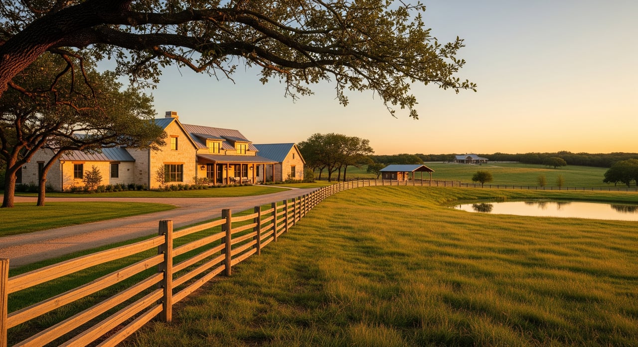
Thinking about a small ranch, hobby farm, or privacy property in Red Lick? Buying acreage is exciting, but the details can make or break your plans. You want to be confident about access, water, septic, soils, and taxes before you commit. This practical checklist walks you through the key steps, the records to gather, and who to call in Bowie County so you can move forward with clarity. Let’s dive in.
How to use this checklist
Use this as a step-by-step plan while you tour properties and during your option period. Start with access and title, then dig into utilities, soils, and taxes. Line up licensed pros for the survey, well, and septic early so you have enough time for inspections. Keep notes on each tract so you can compare.
Confirm legal access and road frontage
A driveway you can see is not the same as legal access. Ask for recorded proof of access via a public road, county road, subdivision street, or a private easement. The title commitment and survey should show how you reach the property on record.
If access is missing or unclear, it can affect financing, building, and resale. Always verify legal access in writing before moving ahead. Your title company and a licensed Texas land surveyor can confirm the details.
Order a current survey and review title
A current boundary survey helps you avoid headaches. It can reveal fence encroachments, off-line driveways, and easements that limit where you can build. Ask for a metes-and-bounds description or a survey plat prepared by a licensed Texas surveyor.
Review the title commitment and recorded documents for easements, rights of way, deed restrictions, and any mineral reservations. In Texas, mineral rights are often separate from the surface. Pipelines or lease activity can affect how you use certain parts of the land.
Verify utilities and on-site systems
Drinking water: public or private well
Some Red Lick properties near town or subdivisions may have public water. Many rural tracts rely on private wells. If a well is present or planned, get any available well logs, recent water quality tests, and practical yield information. Licensed professionals should handle any work on the well.
- Confirm licensing with licensed water well drillers and pump installers.
- Check local groundwater context and well records through groundwater resources and well records.
- Test for coliform bacteria and nitrates, and ask about any locally relevant contaminants.
Septic systems and site suitability
Most acreage in Bowie County uses an on-site sewage facility. Soil type, slope, and setbacks determine what system is possible and where it can go. Ask for any septic permits, system records, or a site evaluation. A licensed provider should inspect an existing system or assess the site if you plan to install one.
- Review state rules and best practices in state OSSF standards and permitting.
Power, gas, and internet
Confirm which electric provider serves the area and any fees for new service or line extensions. Three-phase service may not be standard. Natural gas is not always available on rural tracts, so many owners use propane for heating and cooking. Internet options vary by location, from fixed wireless or satellite to limited fiber or cable near town. Ask neighbors and providers about real-world speeds.
Locate utilities before you dig
If you plan to add a driveway, drill a well, or set fence posts, call for utility locates first. Use Call 811 before you dig and confirm any easements that limit where you can put improvements.
Evaluate soils, drainage, and flood risk
Soils and building feasibility
Soils affect everything from septic performance to pasture health and pond potential. Pull a soil map and review the soil types on your target tract. Look for shrink-swell risk, erosion potential, and the best areas for a home site, barn, or leach field.
- Start with the USDA NRCS Web Soil Survey.
Flood zones and insurance
Check FEMA maps to see if any part of the tract sits in a floodplain. Floodplain rules can affect building locations and may require flood insurance. Ask the seller about historical ponding or drainage issues, and walk the low spots after a rain if possible.
- Use the FEMA Flood Map Service Center to identify flood zones.
Timber, habitat, and ag potential
East Texas tracts often include pine-hardwood mixes that add privacy and value. If timber is part of your plan, a consulting forester can assess stand health, harvesting options, and replanting strategies. Timber productivity may also qualify for special appraisal programs.
- Learn about management and tax programs through the Texas A&M Forest Service.
For livestock or hay, evaluate existing forage, water access, and fencing. Stocking rates depend on soils, rainfall, and pasture condition. Invasive plants can reduce carrying capacity, so get local guidance on pasture improvement and brush control.
- Tap local expertise at Texas A&M AgriLife Extension.
Taxes, ag appraisal, and permits
Agricultural appraisal and rollback taxes
Texas offers open-space agricultural appraisal for qualifying land uses. Requirements include minimum intensity and continuity of use, and timber tracts may have separate appraisal pathways. If land comes out of qualifying use, rollback taxes can apply for prior-year savings plus interest. Ask the seller about current status and keep records of your qualifying activities if you plan to apply.
Local permits and who to call
If your tract falls within Red Lick town limits, confirm local building or utility permits. For rural tracts, check county-level driveway permits and road access coordination. Septic permits go through the local authority in line with state rules. Confirm any well permit or registration requirements and verify who maintains your road.
Fencing, boundaries, and use rights
Do not assume existing fences sit on the boundary line. Compare the fence line to your survey and note any encroachments, shared fences, and gate locations. If a recorded easement crosses the property, it may affect where you build and how you fence.
If hunting or wildlife use matters to you, verify whether those rights convey at closing. Some properties have leased hunting rights that renew seasonally, and you should review any agreements during escrow.
Walk-the-land checklist
- Drive the recorded access from a public road and confirm it matches the title and survey.
- Time the drive to town services and note road conditions in wet weather.
- Look for low spots, erosion, and natural drainage paths after rain if possible.
- Check fences, gates, and signs of trespass or encroachment.
- Ask neighbors about flood history, utility reliability, and internet options.
- Flag your preferred home site, barn, and septic areas to see how they fit with setbacks, soils, and easements.
Documents to collect before or during escrow
- Current boundary survey from a licensed Texas surveyor.
- Title commitment, recorded deed, and any plat or deed restrictions.
- Recent tax records and agricultural or timber appraisal history.
- Well logs, production details, and recent water quality test results.
- Septic permits, maintenance records, or a site evaluation for a new system.
- FEMA flood zone determination and an NRCS soil map printout.
- Utility provider list with confirmation of serviceability and any extension fees.
- Timber assessment or forester letter if timber value matters to you.
Your professional team
- Licensed land surveyor to map boundaries and easements.
- Title company or real estate attorney to review title exceptions and mineral rights.
- Licensed well driller or hydro pro to evaluate well yield and water quality.
- Licensed OSSF professional for septic inspection or site suitability.
- Consulting forester for timbered tracts or management plans.
- County Road and Bridge or county engineer for driveway and road coordination.
- Local Extension agent for soils, forage, and stocking guidance.
Timeline and offer tips
- Build in enough option time to complete the survey and inspections, especially for well and septic.
- Make your offer contingent on receiving critical records, including access documents, ag appraisal status, and utility confirmations.
- Budget for start-up and maintenance items that often come with acreage, such as fencing repairs, driveway work, brush control, and utility extensions.
- Do not start improvements until you confirm easements, setbacks, floodplain status, and any permits.
Ready to find the right Red Lick acreage with confidence? If you want a seasoned local advocate who specializes in lifestyle and acreage properties around Texarkana, reach out to Teresa Liepman for buyer representation and practical guidance from contract to close.
FAQs
How do I confirm legal access when buying land in Red Lick?
- Ask for recorded easements or a plat that shows access, review the title commitment, and get a survey that maps deed lines and access routes.
Is public water available for Red Lick acreage?
- Some tracts near town or subdivisions may have public water, but many rural parcels use private wells; confirm availability with the local provider before you buy.
Do I need a septic inspection on rural Bowie County land?
- Yes, have a licensed OSSF professional inspect any existing system or evaluate the site for a new one and check state rules through TCEQ.
How can I check whether mineral rights are included with the property?
- Review the title commitment and recorded deeds for reservations or leases, and consult a title attorney if ownership is unclear.
Can my Red Lick acreage qualify for agricultural tax appraisal?
- Possibly, if you meet open-space requirements for bona fide ag or timber use; apply with the appraisal district and confirm any rollback exposure.
How do I evaluate flood risk on a tract?
- Use FEMA flood maps to check floodplain status and walk the land for drainage patterns, then discuss any local rules for building in mapped areas.
Who do I call to locate utilities before I dig or drill?
- Call 811 to request utility locates and verify any recorded utility easements that could affect where you place improvements.